THE ORIGINAL Potomac Heritage Trail extends for just 20 miles along the Virginia side of the Potomac River. The National Park Service has since expanded the definition to include over 800 miles of trail on both sides of the river, from the mouth of the Potomac to the Ohio River Basin. DC is the central node in this network connecting the C&O Trail, Mount Vernon Trail, Civil War Defenses of Washington Trail, and the Southern Maryland Potomac Heritage Trail Bicycling Route.
Jump to: Virginia Side | Maryland Side

For this guide, I’ll focus on the two banks of the river extending from Washington to less than an hour’s drive northwest of the city. This section of the river was the historical stomping ground of George Washington and a key passageway for the Underground Railroad.
Note for Cyclists: South of Key Bridge, Virginia trails are paved and well marked for cyclists all the way down to Mount Vernon. On the Virginia side, biking is prohibited (and unsafe) northwest of the Key Bridge except for the Great Falls segment from Difficult Run to the southeast border of Seneca Park and again from Elizabeth Mills Park through Loudon County [1]. The entire DC / Maryland side of the river — along the 193-mile C&O Canal — is flat and bike-accessible. Unlike Rock Creek Park and the Capital Crescent, the C&O trails are loose gravel paths best suited for mountain bikes and hybrids.
Note for Boaters: You can put in a kayak or canoe just about anywhere on the DC side — though there are safety issues as you get closer to Great Falls. The most popular DC put-ins include Jack’s Boathouse, Fletcher’s Cove, Lock 5, and, to the south, East Potomac Day Dock (on Hains Point, directly across from The Wharf). Farther northwest of the city, portage at Violettes Lock.
Most of the Kayakers I run into on the Virginia Side have put in at Roosevelt Island. Hauling a kayak down the Virginia palisades is nearly impossible, so the next proper boat launch is at Riverbend Park, with the lot just steps from the river. There’s also a good boat launch at Algonkian Park. I have seen kayaks put in at Chain Bridge, but I wouldn’t recommend it as there is a swift and dangerous undertow.
Virginia Access: Potomac Heritage
- Roosevelt Island ( 9m)
- Windy Run ( 6m)
- Donaldson Run ( 8m)
- Gulf Branch ( 10m)
- Chain Bridge ( 9m)
- Turkey Run ( 14m)
- Scott’s Run ( 13m)
- Difficult Run ( 21m)
- Great Falls VA ( 25m)
- Riverbend Park ( 26m)
- Seneca Park ( 29m)
- Algonkian Park ( 32m)
- Bles Park ( 35m)
- Elizabeth Mills Park ( 35m)
* Driving estimates are from central Arlington
Jump to: Maryland Access

FOR A SCENIC view of the Washington Monuments, ride along the paved bike trail extending along the George Washington Parkway. The bike trail begins south of the city at Mount Vernon and extends north to the Key Bridge in Rosslyn.
Teddy Roosevelt Island
- Theodore Roosevelt Island ( 8 min)
- Access: Easy ( 2 min)
There are a number of parking areas along the GW Parkway, but the most popular is Teddy Roosevelt Island. Although technically in the District, it is only accessible from the Virginia side. From the (usually crowded) parking area on the GW parkway, cross the foot bridge to the loop around the island.

Although Eric Gugler’s Roosevelt memorial plaza on the Northern side of the island is the most common destination, there are a number of other interesting points to explore, including the ruins of a mansion owned by the family of Founding Father George Mason. Much of the natural scenery enjoyed by the island’s first inhabitants (Nacotchtank and Piscataway) remains, with particularly expansive views of DC on the eastern side. [4]

To access the Potomac Heritage Trail from Roosevelt Island, follow the trail that splits off from and goes under the concrete bike path overpass, immediately to the north of the parking lot. This part of the trail is wedged between busy traffic lanes and the river, so you’ll mostly hear engines as you step over detritus from past traffic accidents and homeless encampments.
Don’t give up! Continuing northwest takes you past the Key Bridge, then along an exposed shoulder of the GW parkway, and finally to a wooden pedestrian bridge beside the mouth of Spout Run. Here the trail transitions from wide-open spaces with expansive city views to a wilderness path along the base of high bluffs.

Take a last look at the houseboats and paddle-boards between the Georgetown skyline and the Three Sisters (small rocky islands that mark the turn-around point for most renters from Jacks). From here on out, the trail will be far more welcoming to those looking for a peaceful walk along the river and a taste of wilderness.
Adventure awaits! The area along the base of the bluffs are also thick with cormorants, Canada Geese, and more exotic water-fowl. Finally, you’ll come to the first of many waterfalls dumping into the Potomac from the Virginia bluffs. Just south of the steep waterfall at Windy Run is a series of narrow rock steps that will lead you back to civilization.
Windy Run
- Windy Run Park, Arlington, VA ( 6 min)
- Access: Intermediate ( 10 min)
Windy Run is the closest access point from central Arlington, but the hike down to the river is difficult. In spite of this, Windy Run is relatively unknown, even by locals, so you can usually find some alone time here even on a Saturday afternoon.
After parking at the trailhead off a suburban cul-de-sac, follow the easy trail down Windy Run. As you approach the first crossing, the trail becomes a set of rock steps. There are two more crossings before passing under the GW Parkway and a final crossing at the top of the bluffs. Ignoring the usual accidental death and dismemberment sign, follow the handrail down the right side of the falls.

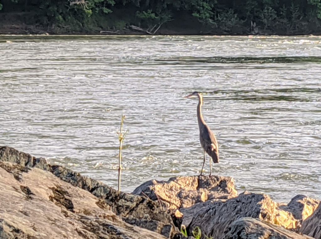
From the base of the falls, proceed either south along the river (to a series of popular fishing holes and hammock spots) or north to one of the most isolated patches of wilderness in the city. In the morning, Great Herons roost along the shore here and, if you tread softly, you will likely catch them before they flush.
Continuing on the river path towards Donaldson Run, your first landmark will be a rock slide with a large boulder that seems to be balancing on a small corner (38.908, -77.098). Next, you’ll come to a thin waterfall that drizzles over a sheer cliff face (38.911, -77.102).
Near there, you might also see the remains of a June, 2020 car accident. After careening off the 100′ bluffs, the driver somehow managed to extricate himself from the wreck and walk to the river, where he was picked up by a DC rescue boat.

Further along are a couple of old steam boilers that were part of a 19th Century mining operation near the southern corner of what is now Potomac Overlook Park.
The last landmark before you reach Donaldson Run is the Rope Swing. I’ve always been too chicken, but many of my friends have done it (including one nut-job who dives off from the top of the tree), and they’re all still with us.
Potomac River Gorge (Donaldson Run)
- 3909 30th Street ( 8 min)
- Access: Intermediate ( 20 min)

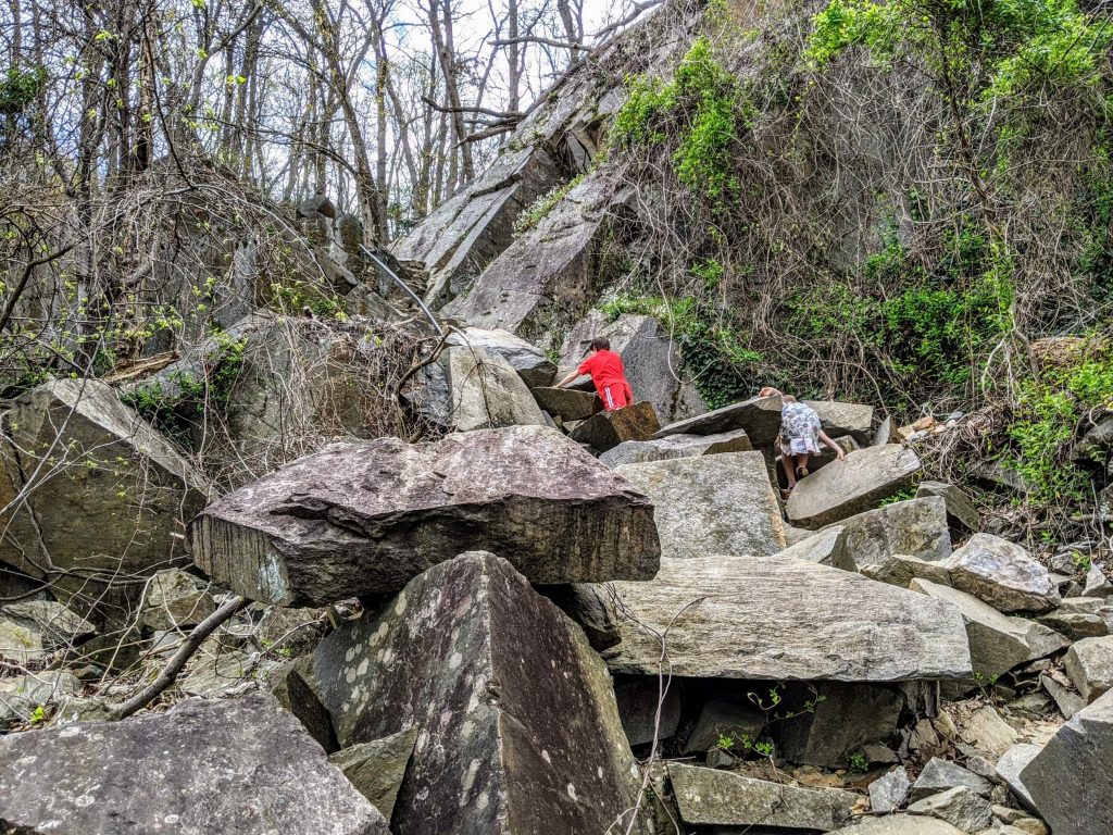
Donaldson Run is a longer walk to the water, but this is one case of the journey being even greater than the destination. My kids call this “Parkour Gorge” because of the giant boulders and challenging river crossings, and it was once called Potomac Gorge by locals. It really is a gorge, with steep hills on either side and a wide open valley of giant trees by the river bottom.
The gorge also has a stunning history, dating back to the late nineteenth century, when Washingtonians kept a summer cabin in Arlington to cool off from the summer heat while remaining a short train ride from the city. Pola Negri (the silent film star) kept a house here, in what is now the Donaldson Run nature center. There was also a dam (long since washed out in a flood) that was used to form a swimming hole for the well-to-do.
The Gulf Branch “Precipice”
- N Nelson St & 36th Road North, Arlington, VA ( 10 min)
- Access: Difficult ( 9 min)
We call the access point at N Nelson “The Precipice” because it reminds us a little of the Precipice Trail in Acadia National Park. It is a difficult climb and especially hard to maneuver with fishing tackle or small children. A narrow trail with a handrail is hidden off to the left as you look down from the top of the falls.
Maybe skip the segment of trail from Gulf Branch to Chain Bridge. The fishermen dump their fish and trash here, so it’s a popular spot for vultures, and the stench can be strong on a summer day.
Chain Bridge
- 4101 N Randolph Ct ( 9 min)
- Access: Easy ( 3 min)
Though it has been rebuilt many times, the site of the Chain Bridge is the most historically significant crossing on the Potomac. It provided a safe escape route for the Declaration of Independence during the British invasion of Washington in 1814. The document was saved by the sole efforts of a government clerk named Stephen Pleasonton, who spirited Jefferson’s proclamation across the river and stashed it in a grist mill near the foot of the bridge. [7]

The base of the Chain Bridge is the most popular fishing hole in North Arlington, so arrive before 8a if you want to catch a fish. This is also where the fish begin to be safe to eat, as it is just above the city. Parking spots by the bridge are also scarce later in the day, but I’ve always been able to find a spot in the neighborhood at the top of the bluffs.
Turkey Run
- Turkey Run Park ( 17 min)
- Access: Easy ( 10 min
Turkey Run Park gets an A for accessibility. Directly off the GW Parkway (I recommend parking lot C1), you’ll find a gentle path down to the water. As the trail becomes steeper, you’ll descend well-maintained steps (thanks to the National Park Service).
As you near the river, the foliage becomes lush, almost reminiscent of a tropical rainforest. You might hear the call of a Carolina Wren or a Cardinal, and you are certain to find toads and dozens of tiny fish where the Potomac Heritage Trail crosses Turkey Run. The Potomac has a number of small, alluring islands along the shore here, so keep an eagle eye on your kids. The currents along this part of the Potomac are swift and deadly.

Scott’s Run
- Scott's Run Parking Lot ( 13 min)
- Access: Easy ( 20 min

Scott’s Run was originally the home of an early 20th Century Washington DC lawyer named Edward Burling. Real Estate Developers planned a riverside community until a grass-roots movement of local citizens successfully lobbied to turn the land into a regional park and nature preserve.
Today the park’s wide trails provide an escape from the suburban sprawl of Northern Virginian. If you’re hoping for solace (and a parking spot), arrive before 9a.
Local Secret: if you can’t find a spot in the main lot, drive around to the Langley Swim and Tennis Club, which usually has a few empty spots. The blue trail kicks out right in the lot, so you can bang a right and be on the water in 10 minutes.
Difficult Run
- Difficult Run Parking Lot ( 21 min)
- Access: Moderate ( 30 min)
With wildflowers, bike trails, and rich history, Difficult Run offers something for everyone. We call it “Difficult Parking” because the lot fills up early on weekends, but 4x4s and adventurous pinto drivers can also park on the muddy shoulder along Georgetown Pike (anyone else will get stuck).
This is probably the most scenic hike down to the river. The trail follows the beautiful Difficult Run, which at times feels like a trout stream in Montana, especially around dusk. Kids will enjoy hopping from rock to rock and peeping fish along the fast-moving rapids.
This is also the secret southern entrance to Great Falls Park, and there is much to see here on this side. While the entire C&O Canal system is on the Maryland side of the river, George Washington’s Patowmack Company also planned a series of locks on the Virginia side to help boaters navigate around Great Falls. In 1793 Robert E. Lee’s father Lighthorse Harry Lee built a small town — which he called Matildaville, after his first wife — to provide housing for the canal builders. You can still see the locks and foundation of the Matildaville gristmill and iron foundry near the falls. [2]
Cyclists will appreciate the swoopy gravel trails which host the annual NoVa Epic Northern Tour race. Follow the trail southeast out of the parking lot to the Georgetown Pike crossing, where the trail turns north into Great Falls National Park. After the Great Falls overlook, head up through the North Lot to the Carriage Trail (closed to motorists) that connects to Riverbend Park. If you enjoy the riverside segment, you can continue on a spur that goes all the way to the southern border of Seneca Park and then track back and follow the loop to the right through the hills above Riverbend Park.
Virginia Side of Great Falls NP
- 9200 Old Dominion Dr, McLean, VA 22102 ( 21 min)
- Access: Easy ( 5 min | 7 min)

Although it is far less crowded than the Maryland side, the trails around Great Falls NP in Virginia can get pretty busy on weekends. Beyond the spectacular views of the falls, you’ll also enjoy watching climbers and kayakers challenging themselves on the cliffs below. Kids also love exploring the rock halls and boulders along the river path. Entry fee is $15 per vehicle, free for National Park pass-holders and some organized groups.
Riverbend Park
- Riverbend Park ( 26 min)
- Access: Easy ( 2 min| 1 min)
The North Trail along the river in Great Falls National Park connects to Riverbend Park at the Washington Aqueduct dam (see above). Unlike the entire river to the southeast, Riverbend is outside the DCA flight path, so it starts feels like real wilderness, and silence is the most noticeable feature of these woods.
Bikers can ride on the entire Potomac Heritage Trail section from Weant Drive south of the boatramp to the park’s northwest border. Continue on foot along the river beyond Weant to enter Great Falls, or take Weant Drive to continue on bike. As you exit the park gate on Weant Drive, you’ll find a carriage road off to your left which continues to the North River Parking Lot in Great Falls National Park.
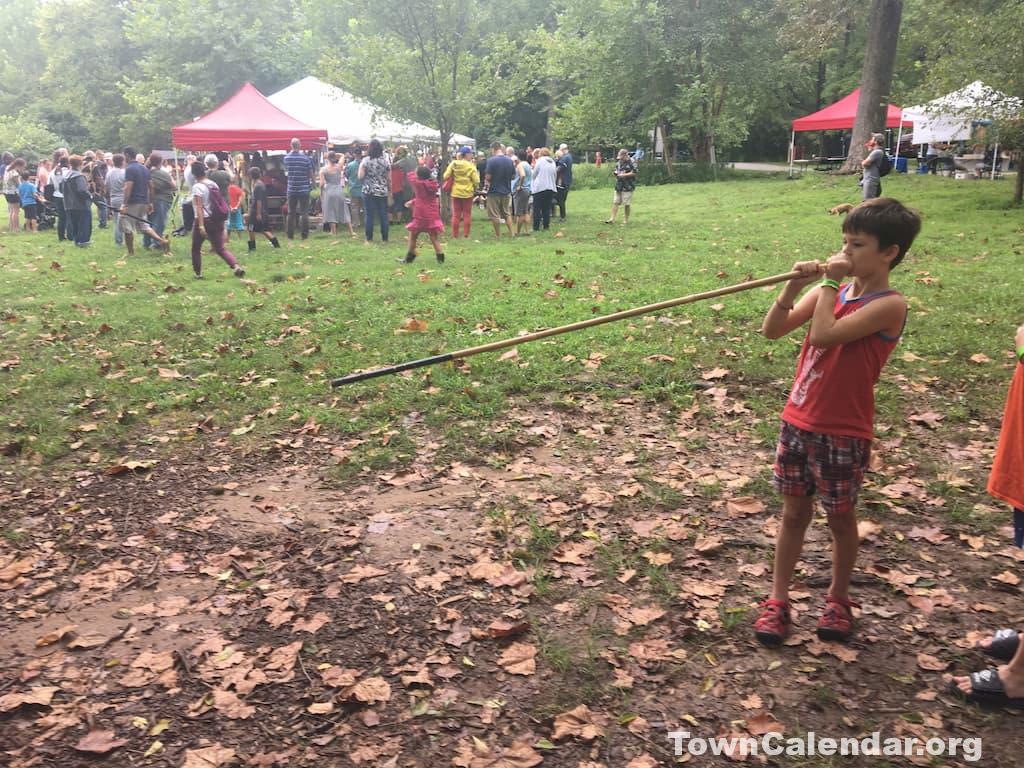
With a parking lot that is just steps from the river walk and boat ramp, Riverbend the most accessible park on the Virginia side. The park is most popular in the Spring, when bluebells and other wildflowers crowd the banks of the river. In Summer, there is an American Indian Festival with drums, traditional dances, and demonstrations of early life along the Potomac River.
The Bootlegger Trail loop is worth exploring for its variation of thick woods and open fields and is easily accessed with a bike or on foot. Alternatively, continue north for two miles from the boatramp to the park boundary. The Potomac Heritage Trail is not bike-able beyond the boundary, but you can continue on foot along the trail. In about 3 miles (1 hour) you will reach the boundary of Seneca Regional Park.
Seneca Regional Park
- Seneca Regional Park ( 30 min)
- Access: Moderate ( 25 min)

First a word of caution: don’t attempt to park at Watermark Place (on the Trump Golf Course side of the park). You won’t get pepper sprayed (unless you sit on the grass), but Judge Smails will absolutely tow your car. And as we learned the hard way, the official Seneca lot (half a mile away as the crow flies) is a 20 minute drive — by some unfathomable feat of Civil (or was it Social?) Engineering.
Still, you can legally stomp your muddy feet directly through the Trump Course by following the Potomac Heritage Trail at the bottom of the road near the lot. I recommend bringing a shovel to build sand castles in the traps or, if you’re feeling especially bold, fishing equipment to see what giant koi you might be able to pull out of the meticulously landscaped water features on Lowes Island.
East along that same trail will take you into the heart of Seneca Park, where the Potomac winds its way through a dozen tiny islands on the Virginia side. The waterside is littered with beer bottles and other detritus, and the bluffs become treacherous if you wander off the main trail for a better view of the river. Not my favorite Potomac access point, but the forest is cool in the summer and you can sometimes find wild raspberries by the trail.
Algonkian Park
- Algonkian Park ( 26 min)
- Access: Easy ( 5 min | 3 min)

Algonkian Park is a major recreation area for Fairfax County, with a waterpark, golf course and boat ramp. It’s also meticulously manicured along the river, which makes it a great place to have a family cookout or just sling a hammock and watch the river go by.
Elizabeth Mills Park
- Elizabeth Mills Riverfront Park ( 35 min)
- Access: Easy ( 5 min | 3 min)
Further up the Potomac is Elizabeth Mills Riverfront Park, an oasis squeezed between a golf course and a river. The parking lot is small, so plan to get there by 10a on weekends or just park in the neighborhood and walk down the hill.

Both the parking lot and the paved access trail are shared by the neighboring Landsdowne Golf Club, so be prepared to cavort with intoxicated bros in polos (maybe pack some bear spray?). When the paved golf cart trail turns left, continue straight onto the gravel path which winds gently down to the Potomac Heritage trail along the riverfront.
Aside from the occasional sound of screeching golf cart tires and burping men, the park is quite peaceful. Where the access trail meets the Potomac Heritage Trail, there is an excellent outcrop of rocks that forms a natural fishing pier. There are also plenty of good spots to toss a hammock and the trail is fine for easy mountain biking.
Further afield on the Virginia side
There are a number of other easy access points to the Potomac. Popular access points south of Teddy Roosevelt Island include Lady Bird Johnson Park, the Old Town Waterfront, and Mount Vernon. South of Mount Vernon, the river opens up substantially. If you’re looking for the feel of a beach within a 30 minute drive of DC, look no further than Leesylvania State Park.
Heading Northwest past the beltway, you won’t hit another bridge until Point of Rocks. At Harper’s Ferry, the Shenandoah merges with the Potomac. Northwest of there, it’s more of a mountain stream.
Maryland Access: C&O Canal Trail
Jump to: Virginia Access
- Jack’s Boathouse ( 1m)
- Fletcher’s Cove ( 12m)
- Lock 5 ( 16m)
- Sycamore Island ( 15m)
- Lock 7 ( 15m)
- Lock 8 ( 15m)
- Lock 10 ( 15m)
- Carderock ( 16m)
- Angler’s Lot ( 19m)
- Great Falls MD ( 20m)
- Lock 21 ( 27m)
- Lock 22 ( 34m)
- Violettes Lock ( 36m)
- Seneca Mill ( 38m)
- McKee-Beshers ( 42m)
- Points Beyond
* Driving estimates are from Georgetown
MOST PEOPLE do the canal all wrong: going as far as they can in a day and never meandering. And sure, you can do that. It’s a 200-mile mule highway. It’s even possible to bike it in three days if you stop only for water, bathroom breaks and sleep.
But do your soul a favor. Step off the trail. Discover the sublime, hidden beauty just beyond the green curtain by the side of the towpath. If you take a moment to stop and wonder, you just might start to get a feel for the Canal’s important place in the American story.
As an entrepreneurial project, the canal was conceived by George Washington to provide a navigable shipping line between Georgetown and the rich coal fields near Cumberland.
Upon its completion in 1850, houseboats towed by mules and laden with manufactured goods from Georgetown began the long, four day journey up the nearly 200 miles of the canal. The canal also proved a crucial supply line for Union troops during the Civil War, surviving numerous attempts by Confederate sympathizers to destroy its massive rock walls. [2]
When was the C&O Canal built?
1850. Although conceived by George Washington, the C&O canal was not completed until after his death.
How long does it take to bike the C&O Canal?
Three Days. The C&O Canal is nearly 200 miles long and was traversed by mule-drawn houseboats over the course of four full days and nights.
For an ambitious biker, it can be completed over a long weekend. Take Amtrak from Union Station to Cumberland on a Friday and spend the night there. Bike all day Saturday, Sunday and Monday, stopping at campgrounds along the way.
But what the Confederates could not destroy proved no match for nature and commerce. The Great Flood of 1889 disrupted travel along the canal and while the repairs languished, most of the trade shifted permanently to the more cheaper (though less energy-efficient) B&O Railroad, connecting coal country with the deep water port of Baltimore.
In 1950, plans to run a freeway along the Maryland side were foiled by a dedicated conservation group led by Supreme Court Justice William O. Douglas. Thanks to their efforts, the entire trail is now a National Park and protected playground for nature enthusiasts.
The easiest access for DC residents is Georgetown. You can park under the Whitehurst Freeway on K Street most days and hop on the C&O Trail. Nearby Jack’s Boathouse rents canoes for a modest fee. Just beyond Jack’s, the trail branches. To the right is the Capital Crescent Trail and to the left is the C&O Canal Trail, which extends for nearly 200 miles along the Maryland side of the Potomac River.
Most access points happen at the original locks that governed travel along the Potomac River. You will find a footbridge crossing the canal at every lock.
Jack’s Boathouse
- Jack's Boathouse, Georgetown ( 1 min)
- Access: Easy ( 1 min)
Slip under the Whitehurst Freeway to discover the bowels of Georgetown. Between the bustle of cars circling for a parking spot, you’ll find an odd mix of Potomac enthusiasts. Fashionable couples disembark for a night on the town while middle-aged jocks hustle dripping kayaks onto their SUVs. And then there are the college students, slinking behind dumpsters and the odd post in a mysterious cloud of smoke.

Welcome to Jack’s Boathouse (now known as the Key Bridge Boathouse), the terminus of the Capital Crescent Trail and beginning of the C&O Trail. They’ll take you on a paddle-board tour of the monuments for $60 a pop or lend you a canoe for a mere $16 per hour. To pick up the trail, head north beyond the private boathouses where the rowing clubs at Georgetown, GW and American University ply the waves at 6 in the morning (I don’t miss those days).
Although you can take the C&O, if you’re on a bike you’ll want to start on the paved Capital Crescent Trail where it begins just past the old stone overpass by the Potomac Boat Club.
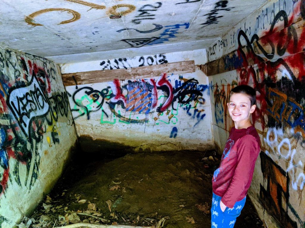
From here the trail runs parallel to the C&O, but the foliage between the trails is too dense to make the switch in all but 2-3 places between here and Fletcher’s Cove, a 15 minute ride up the river. Stop along the way to enjoy the views of rowing shells plying the waves, or to admire the graffiti inside the nearly 200 year-old Foundry Tunnel.

Fletcher’s Cove
- Fletcher's Cove Boathouse, Canal Road Northwest ( 5 min)
- Access: Easy ( 1 min

With ample parking and a quintessential Lock House, Fletcher’s Cove (the official Mile 0 of the canal trail) is an ideal entry point into river life for those who are new to the city and lack equipment. The boathouse is a concession of the National Park Service and will rent you a canoe or row boat for about $25 per hour. They also offer guided tours of the cove and fishing tackle and licenses.
On a recent ride, I saw families cooking out, naked children swimming in the cove, a tightrope walker perched between two trees, and some cheerfully intoxicated fishermen. You can occasionally go inside the Abner Cloud House (considered the “finest example of Federalist architecture in Washington” by the Department of the Interior) to view antiques from the early 19th Century.
One note of caution for boaters, if you plan to paddle north of Chain Bridge, you are better off putting in at Lock 5 (above Chain Bridge), since the current around Chain Bridge is swift.
Chain Bridge
Between Fletcher’s Cove and Lock 5, there is a small lot just north of Chain Bridge. If you don’t mind the confusing traffic directions on Canal Road — just don’t trust your GPS directions — this is the ideal place to stop for one of DC’s best hidden gems.

First begin across the Chain Bridge to find the pedestrian ramp down to the trail. From there, bike less than a third of a mile north, keeping an eye out for a hidden trail heading toward the Potomac. Just after stepping into the woods, the trail opens onto an incongruent paved road blasted through the jagged boulders of the flood plain. There you will catch your first glimpse of the astonishingly close bluffs of Virginia.
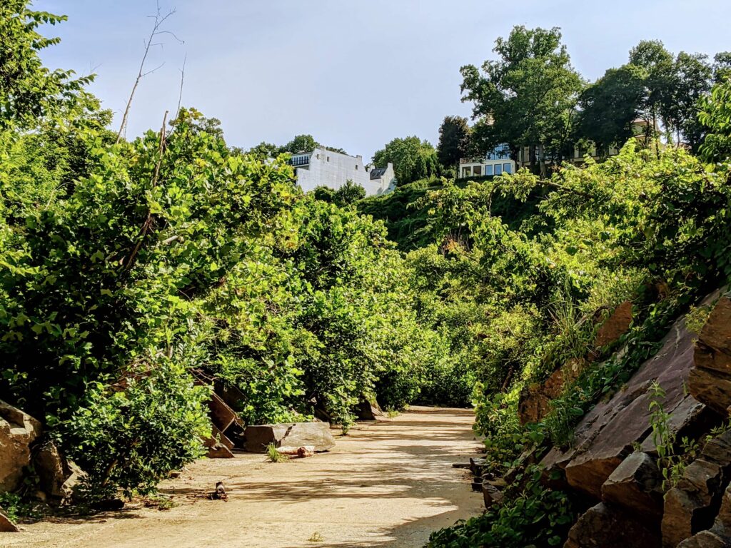
Once you reach the river, take a moment to absorb the strangeness of this place, known locally as the Belvedere Viewpoint. Between the deadly rapids to your right and the familiar fishing grounds around the Chain Bridge are inaccessible mansions built right on the edge of the cliffs.
Who owns these multi-million-dollar maximum security compounds towering over the Potomac? One is owned by the Embassy of the State of Qatar, but a tax record search of the others will reveal only shell corporations [8]. If you take the Chain Bridge Road around the other end of these properties, you will discover a high-security perimeter and armed guards. If I ever write a DC spy thriller, it will begin here.
Lock 5
- C&O Canal Lock 5, Bethesda, MD ( 6 min)
- Access: Easy ( 6 min)
Continue a little farther up the C&O Trail to Lock 5. From this lot, says my trusty mid-twentieth century river guide, you can “portage into the feeder canal around High Island and into the broad Potomac above Feeder Dam No. 1.” [2] I’m not sure how that’s possible, given that the locks are now all hammered shut, but I have seen people loading kayaks into the lot, so I imagine you can take out at the river and hike through the woods without too much trouble.
The great treat for explorers at Lock 5 is the path up the Maryland Bluffs. Continue out of the lot to the spiral pedestrian walkway to the bridge over Canal Road. On the other side, the steep path heads up to a beautiful neighborhood of tastefully expensive mansions overlooking the Potomac river.
Lock 7
- Lock 7, Chesapeake and Ohio Canal Towpath ( 15 min)
- Access: Easy ( 2 min)

Between Lock 5 and Lock 7 is the Sycamore Island Club, a private volunteer-run club (think muddy boater camp). There’s an old pool table with scuffed flaps in the main room, canoes and views of the river. Club members ring a bell to get ferried across, and some members who are also senior officials at the CIA have been known to canoe across from Langley. Membership is only a few hundred a year, but the waitlist is 12 years long and there’s no booze on the island, so… [10]
Lock 8
- Lock 8, Chesapeake and Ohio Canal Towpath ( 15 min)
- Access: Easy ( 2 min)
Lock 8 is a good place to hop on to Cabin John Island, which has extensive trails to discover, otherwise, it’s a bit of a snore (unless you’re really into the history of 19th Century Potomac Lock technology). For this reason, there’s usually good parking.
Lock 10
- Lock 10, Chesapeake and Ohio Canal Towpath ( 15 min)
- Access: Easy ( 2 min)

Lock 10 is the ideal place for a beginner to launch a paddle board on the Potomac. The parking lot is directly off 495 and the walk to the river is short and not too steep. Swainson Island also forms a natural cove that keeps the flow manageable for unsteady novices.
Between Lock 10 and Carderock is an area known as Seven Locks, which is where the grade was so steep it necessitated building the locks practically on top of each other. The Beltway also cuts through this area, which makes for an interesting juxtoposition.

Carderock
- Carderock Recreation Area, Chesapeake and Ohio Canal Towpath, Potomac, MD ( 8 min)
- Access: Easy ( 5 min)
With ample parking and wide open spaces, Carderock is where Washington goes for Potomac riverside concerts and al-fresco dining. The views are good from nearly everywhere in the park, with the exception of the southern end of the Billy Goat Trail, which veers away from the river and into a bit of a wasteland.
Angler’s Lot
- Angler's Footbridge, Billy Goat Trail Section A, Potomac, MD ( 10 min)
- Access: Intermediate ( 10 min)
The Angler’s Lot is the closest free lot to the Great Falls National Park, so it is often full. The National Wildlife Federation has named this portion of the Potomac as one of the 100 best birdwatching spots in North America and it’s easy to see why. The upper trail follows the woods above the canal and is a favorite for birdwatchers, who come to spot nesting Orchard and Baltimore Orioles as well as Tree Swallows, Ospreys, Ring-billed Gulls, Great Crested Flycatchers, Wood Ducks and Green Herons. [5]
The lower trail is the preferred path for families as it offers the easiest grade and open vistas of a couple of lakes to the south of the canal. Plan on a good hour hike along the rugged Billy Goat Trail if you want to see the falls from there (though you can bike it in about 15 minutes).
Great Falls National Park
- Great Falls Parking, Potomac, MD ( 10 min)
- Access: Easy ( 10 min)

There are a number of easy access points beyond Georgetown on the Maryland side. Those wishing to see Great Falls without a hike will have to pay an entrance fee to use the National Park Service lot, but there is a free (sometimes crowded) lot further south near the Angler’s Inn (see above).
But the museum at Great Falls is worth the trip and the Tavern, once a popular watering hole for Confederate spies during the Civil War, is a good place to find history and refreshment.
Violettes Lock
- Violettes Lock ( 12 min)
- Access: Easy ( 1 min)
Violettes Lock, also known as Lock 23, is a popular boat launch.
McKee-Beshers WMA
- Mckee-beshers WMA ( 42 min)
- Access: Easy ( 5 min)
McKee-Beshers WMA is Mourning Dove hunting ground from September through January (they taste like Chicken). My favorite time to go is in late July and August, when the fields are full of sunflowers planted to attract doves and songbirds that migrate along the Potomac. [9]
Points Beyond

Continuing further out of the city on the DC side will take you along the C&O Canal Trail, which was built in the early 19th Century to connect Georgetown with the early coal towns along the far western edge of Maryland.
The town of Williamsport, once the unofficial headquarters of the original hooligans — the Houley Gouley Gang — has a decent barbecue restaurant. [6]

It was along this great Potomac trail that Justice William O. Douglas — who was instrumental in the establishment of the C&O Canal National Park — found solace from the important decisions of his office. In 1968, he wrote:
Wherever one hikes in this area, his heart will be lifted by the flowering shrubs in the spring and the gold and red of the woods in the fall. Much of the way he walks in the steps of George Washington whose West Point training was in this valley, and with scouts and armies that fought the Indian wars and the Civil War. The valley is indeed rich in beauty and in history. [2]
– William O. Douglas
Explore More
- Potomac Heritage Trail: Riverbend Segment, MTB Project, 2020.
- Shosteck, Robert, Potomac Trail Book, Potomac Books, 1968.
- Fisher, Alan, Country Walks Near Washington, Rambler Books, 1996.
- Hedgepath, Dana, A Native American tribe once called D.C. home, The Washington Post, 2018.
- Brown, Robert H. et. al., Where the Birds Are, The 100 Best Birdwatching Spots in North America, Grand Central Press, 2001.
- National Park Service, Life and Death on the C&O Canal, Fall 2009.
- Brennan, Emily, Foraging for Forgotten History Around Washington, The New York Times, July 2, 2013.
- Arlington County Tax Records, Accessed July, 2020. 211 Chain Bridge Road is owned by the Qatar Embassy.
- McKee-Beshers WMA Sunflower Conditions, Accessed July, 2020.
- Melton, R.H., Where Paradise and People Remain Unspoiled, The Washington Post, October 25, 1995.